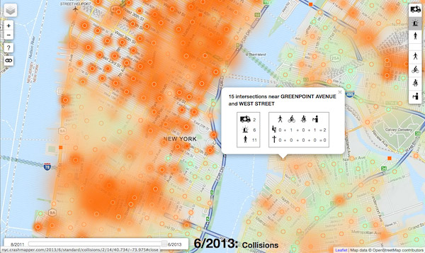
For over a year, I’ve been archiving and processing the New York City Police Department’s collision data on the Crash Data Band-Aid.
With some help from generous people, all valid intersections have been geocoded in the past several months. So now all the collision data, in addition to being free for download above, can be visualized and analyzed in your browser using Crashmapper!
The project is free and open source, you can browse the code on Github
(it’s in the map directory).
Building the map’s been fun. There’s no server-side app — it’s just
a static site on S3 — and all data points for some 30K intersections
over more than 24 months are loaded into your browser for fast analysis. The
base layers are from OSM, and the mapping library is Leaflet. I’m
using a slightly optimized fork of the awesome Leaflet.markercluster
plugin. The “heatmap” is really a bunch of CSS drop shadows around marker
clusters. The real deep-link custom URLs are possible by setting the error
page on S3 to index.html, so that all links are served up through the app’s
Backbone router.
Crashmapper could be adapted to your town. Contact me on the left if you’re interested!
Comments